

West Side CA Homes For Sale
Benicia, California
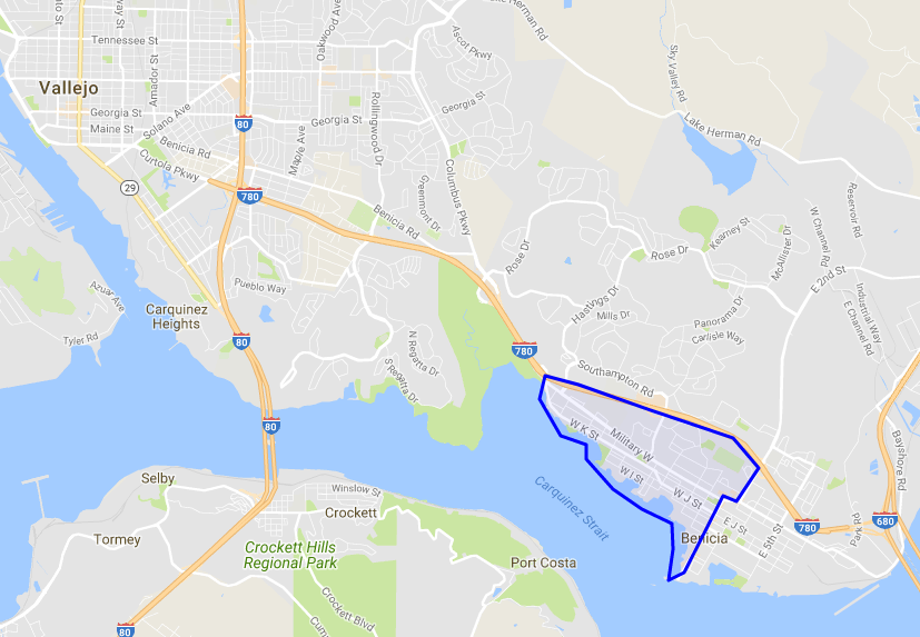
Benicia's West Side neighborhood is located south of Highway 680, all property west of 1st street.
Most of Benicia's oldest homes are located in the East and West Sides. Downtown Benicia is rich in California's history with over 30 historical points of interest. Strolling along downtown's First Street amidst beautifully maintained 19th century and Victorian style buildings is a favorite among visitors and residents alike. Take a walking tour of our historic neighborhoods and notice the Victorian-inspired homes and western architectural examples that date back to the 1850's, while enjoying the selection of comfortable cafes and fine dining opportunities.
West Side CA Real Estate Guide:
ListingsNeighborhoodsNearby CitiesReal Estate AgentsHome Improvement ResourcesSchool InformationWest Side In Depth
Neighborhoods Nearby West Side
West Side Home Improvement Resources
Perhaps you’re not quite ready to sell your home, but need to make a few crucial updates in order to Make your home market ready. Or maybe you need to make improvements before moving in to your newly purchased home. Everything from kitchen and bath remodels, additions, or full cosmetic overhaul, no project is too big or too small.
West Side Real Estate Agents
We have knowledgeable real estate agents ready and waiting to help you buy or sell the perfect home in Benicia. Each of our associates is a host of valuable information about the city and all that it has to offer.
West Side Zip Codes
West Side Market Stats
- 2016 Average sale price is $564,713
- 2016 # of Homes Sold: 80
- 2016 Average Days on Market: 60
West Side Nearby Cities
Benicia is in the southern tip of Solano County, located near major city hubs and smaller urban cores, alike.
West Side School Information
West Side is home to many schools, from elementary to adult schools, both public and private. No matter where you live in West Side , great education is just around the corner.
PUBLIC ELEMENTARY (1 SCHOOL)
Mary Farmer Elementary School
Grades: K-5
901 Military Way
Benicia, CA 94510
PUBLIC MIDDLE (2 SCHOOLS)
Benicia Middle School
Grades: 6-8
1100 Southampton Rd.
Benicia, CA 94510 2
Community Day School
Grades: 7-12
426 East K St
Benicia, CA 94510 N/A
PUBLIC HIGH (3 SCHOOLS)
Benicia High School
Grades: 9-12
1101 Military Way
Benicia, CA 94510 4
Community Day School
Grades: 7-12
426 East K St.
Benicia, CA 94510 4
Liberty High School
Grades: 9-12
350 East K St.
Benicia, CA 94510 N/A
Catholic (1 SCHOOL)
St. Dominic
Grades: K-8
935 East 5th St.
Benicia, CA 94510 N/A
West Side In Depth
Location
Benicia's West Side neighborhood is located south of Highway 680, all property west of 1st street.
Parks and Recreation
Benicia's West Side boasts many wonderful parks. City Park and Gazebo are located in the downtown area, very popular for weddings! Located within City Park is the Playground of Dreams a child's dream come true. Woodhill Park, Willow Park are also available. Ninth Street Park and Twelfth Street Park aka Matthew Turner Shipyard Park are on the waterfront! . Benicia State Recreation Area in within West Side Benicia: The area includes 438 acres of land with 2½ miles of paths set aside for cyclists, runners, walkers, equestrians and roller skaters. The trails roll through the marshy, grassy hillsides and rocky beaches along the narrowest portion of the Carquinez Strait.
Demographics
There are currently approximately 27,300 people living in the city of Benicia. The population density was 2112 people per square mile. The racial makeup of Benicia was 19,568 (72.5%) White, 1,510 (5.6%) African American, 135 (0.5%) Native American, 2,989 (11.1%) Asian, 102 (0.4%) Pacific Islander, 895 (3.3%) from other races, and 1,798 (6.7%) from two or more races. Hispanic or Latino of any race were 3,248 persons (12.0%).
Weather
Cool breezes off the Carquinez Strait keep the weather near perfect with an average temperature of 69 degrees. Our moderate Mediterranean weather produces dry, warm summers and mild falls and winters. The warmest month of the year is July, with an average maximum temperature of 87.40 degrees Fahrenheit, while the coldest month of the year is December, with an average high temperature of around 55 degrees Fahrenheit. The annual average precipitation at Benicia is 19.58 inches. The wettest month of the year is January, with an average rainfall of 4.25 inches.
Attractions
1st street is filled with lots of cool things to do including restaurants, taverns, art shops, boutiques, theatre, live music, spas, fitness studios and plenty of shopping!
Most of Benicia's oldest homes are located in the East and West Sides. Downtown Benicia is rich in California's history with over 30 historical points of interest. Strolling along downtown's First Street amidst beautifully maintained 19th century and Victorian style buildings is a favorite among visitors and residents alike. Take a walking tour of our historic neighborhoods and notice the Victorian-inspired homes and western architectural examples that date back to the 1850's, while enjoying the selection of comfortable cafes and fine dining opportunities.
Benicia has a plenty to offer including a farmers' market on Thursday evenings during the summer months April through October. Other events and attractions include Arts Benicia, the Torchlight Parade over July 4th weekend, Arts in the Park, an Annual summer art celebration in Benicia City Park. Picnic in the Park & Fireworks also July 4th, and the Benicia Peddler's Fair.
Love Sailing? Benicia is an active sailing community. In addition to individual sailing out of the Benicia Marina, there are several organized events and competitions. During the summer months, there is a yacht racing competition on Thursday evenings sponsored by the Benicia Yacht Club. The Yacht Club co-sponsors the annual Jazz Cup regatta with the South Beach Yacht Club, and also sponsors a Youth Sailing Program that offers extensive training.
Benicia offers plenty of opportunities for activities that require water, such as kayaking and fishing, but also for other forms of outdoor recreation that benefit from the beautiful, beside-the-water setting. Benicia State Recreation Area: The area includes 438 acres of land with 2½ miles of paths set aside for cyclists, runners, walkers, equestrians and roller skaters. The trails roll through the marshy, grassy hillsides and rocky beaches along the narrowest portion of the Carquinez Strait. Dillon's Point is a favorite fishing spot. The State Recreation Area is also home to the Forrest Deaner Native Plant Garden sponsored by the California Native Plant Society.
Bay Ridge Trail: A walk along this trail follows the Carquinez Strait waterfront through Benicia and Vallejo. Enjoy breezes and occasional fog as you watch the San Joaquin and Sacramento rivers funnel into San Francisco Bay. This route travels mostly level trails, including sidewalks, paved and unpaved trails and paths.
Matthew Turner Park: Located at West 12th Street, this park is suitable for fishing, picnicking and launching kayaks and canoes.
Benicia Point Pier: This is a great place to drop a line and see what's biting. For more details about where to go fishing, visit Benicia Bait and Tackle.
West Ninth Street Boat Launch: This is a public launch operated by the City of Benicia at the West Ninth Street Park, located at West Ninth and K streets. In addition to the two public boat launches, there are three kayak and canoe put-ins along the waterfront that provide easy access to a day of fun on the Carquinez Strait.
Community Resources
The Benicia Fire Department is located in Benicia West Side, right at City Park. You will also find the Benicia Chamber of Commerce. Additional community resources are available throughout areas of Benicia.
Healthcare Resources
Healthcare resources are available throughout areas of Benicia.
Military
Neighboring Fairfield is home to the Travis Air Force Base, which is under the operational control of the Air Mobility Command. It is located just 3 miles east of the main business district in Fairfield. The 60th Air Mobility Wing is the largest wing in the Air Force’s AMC command, and is the host unit at Travis AFB. Travis AFB handles more cargo and passengers through its airport than any other military terminal in the nation. The base has had a major impact on the Solano County community, as many military families and veterans have chosen to make the county their permanent home. It is also the largest employer in the entire county and greatly helps the area’s overall economic stability.
Education
There are numerous schools located throughout the city for children to attend. West Side is served by the Benicia Unified School District. Benicia Unified School District has an enrollment of over 4,900 in 10 schools. There are also parochial schools, pre-schools, and day care centers in the area. Over 30 colleges and universities within the Bay Area and Central Valley are within easy commuting distance from West Side.
Real Estate
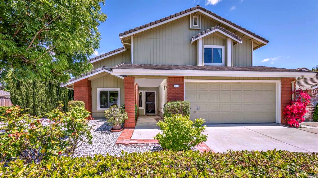
There is a wide range of homes available to buy or rent in West Side. The median sales price is approximately $432,500. A majority of the available homes are single-family homes, built during the mid-late 20th century. West Side’s strategic location, extensive transportation networks, readily available and value-priced properties, and proximity to Northern California's attractions all make it a prime location to live.

")


© 2023 Your Brokerage and Moxi Works © 2023 Coldwell Banker Real Estate LLC. A Realogy Company. All Rights Reserved. Coldwell Banker Real Estate LLC fully supports the principles of the Fair Housing Act and the Equal Opportunity Act. Each Office is Independently Owned and Operated. Coldwell Banker®, the Coldwell Banker Logo and "We Never Stop Moving" are registered service marks owned by Coldwell Banker Real Estate LLC. BRE# 01935235
